

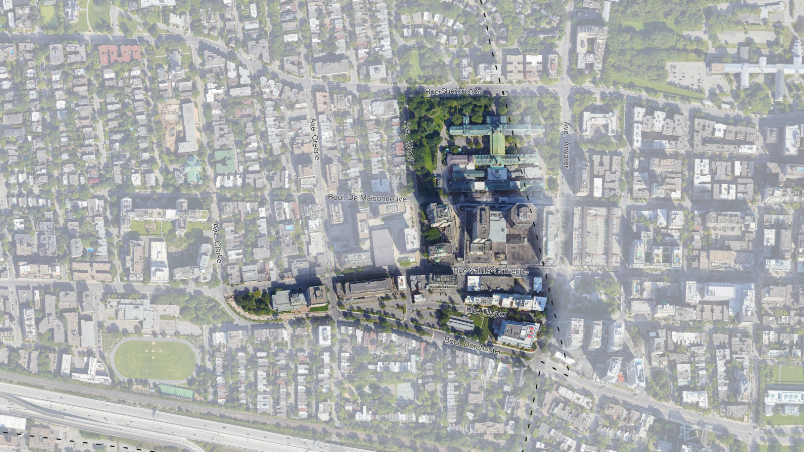
Southeast sector: bounded by Sherbrooke Street to the north, Atwater Avenue to the east, Dorchester Boulevard to the south and Wood Avenue to the west.
The targetted sector also includes the area between rue Sainte-Catherine and boulevard Dorchester, from their junction in the west to avenue Wood in the east.
A Special planning programme (SPP) allows the existing urban plan to be modified. As part of this project, the SPP will make it possible to direct urban planning guidelines over a specific area. This SPP will be a catalyst for the revitalisation of the southeast sector of Westmount, and citizen participation will contribute greatly to its success.
The Special Planning Programme for the Southeast sector of the City was adopted by Council at a special meeting held on Thursday, September 18, at Westmount City Hall.
As required before the SPP may come into effect, a Certificate of Compliance from the Agglomeration of Montreal was received within 120 days of its adoption. The certificate was signed on December 5, 2025, and may be consulted in the documentation list below.
The Westmount Master Plan sets out the City’s broad planning and development guidelines. This plan, along with its implementing instruments (such as the zoning by-law and the by-law on site planning and architectural integration), establishes a framework for the protection and, in some cases, redevelopment of neighbourhoods, streets, buildings and vacant spaces.
Throughout this project, participatory phases will put forward the ideas of those who live in the area, notably through a survey and public consultations. Let's imagine the future of the Southeast sector!
The densification of the southeast sector of the City of Westmount, as part of the Imagine Westmount Southeast project, is part of a broader effort to revitalize the area. The Special Planning Program (SPP) aims to rethink the development of this sector to make it more dynamic, inclusive, and functional. Densification would allow for the addition of new housing and the integration of local services (such as shops, community facilities, and green spaces). The south-east sector is currently in critical condition, with many underused or vacant spaces, and it does not attract investment. The current zoning has not generated new development in several decades. Well-planned densification, close to public transit infrastructure (including proximity to Atwater metro station and several bus lines), is a sensible response to many of the challenges cities face today and in the future: sustainable mobility, climate resilience, the housing crisis, and the efficient use of public infrastructure.
There are currently 431 residential units in the sector. With the SPP, it will be possible to add around 1,000 residential units.
On June 9, 2025, the Communauté métropolitaine de Montréal (CMM) adopted the revised Metropolitan Land Use and Development Plan (PMAD) for the first time. This document sets a minimum density threshold of 480 dwellings per hectare for the TOD hypercentre of the Atwater metro station. This threshold is a requirement, not a suggestion, as stated on page 94 of the document (in French): "La CMM demande aux MRC et aux agglomérations d'intégrer à leur SAD les seuils minimaux de densité prescrits pour les secteurs PIAT, les ESR et les secteurs hors PIAT, de leur territoire respectif, y compris pour les portions des secteurs PIAT qui s'étendent sur leur territoire depuis une MRC ou une agglomération voisine, en conformité à l'annexe 2." The Southeast Special Planning Programme (SPP) sector is not part of this district. In the coming years, the Agglomeration of Montréal will need to harmonize its Land Use and Development Plan by incorporating these density thresholds. Finally, local municipalities, including Westmount, will also need to do the same with their Urban Plan. The PMAD is presented as the metropolitan planning programme for 2026–2046. It is therefore a long-term vision that can be implemented over a significant period.
The implementation strategy is based on the principles of integrating the urban form into the existing context. The first principle is to take account of sunlight and the orientation of the built environment in order to mitigate the impact of shadows cast on the ground and on neighbouring properties. Next, it is important to ensure that the scale of the building corresponds to the human scale, minimizing the feeling of being oppressed by the building and therefore ensuring that the setback and volumes between the podium and the towers are carefully articulated. Finally, the slimmed-down towers provide comfortable, intimate accommodation by limiting direct views between buildings. The interior composition of these towers demonstrates the value of thinking around a central core and supports flexibility in the housing offer.
The City’s objective is to increase the housing supply while allowing for a variety of housing types, by adapting its existing standards for their configuration and reducing the required number of parking spaces. The housing supply will be better suited to the context of a TOD (Transit-Oriented Development) area. As part of the SPP, the City is also introducing an incentive zoning tool that will allow, under certain conditions, additional density for two properties. One of these conditions is the construction of affordable housing. Finally, the City owns two lots in the area and may choose to attach affordability conditions to their sale if it wishes.
The City of Westmount has substantially modified its regulatory provisions to ensure better integration with heritage buildings. Site Planning and Architectural Integration Program (SPAIP) criteria have been developed to ensure neighbourhood quality. Through the proposed changes, the City promotes a human-scale approach throughout the sector and emphasizes the use of base buildings (podium) in all sub-sectors of the SPP. It is also worth noting that each project will be reviewed by the Urban Planning Advisory Committee (PAC) to ensure its integration into the surrounding environment and to guarantee the highest architectural quality.
The SPP was developed in collaboration with all City departments. The need to upgrade infrastructure in the area is known and required, with or without the SPP. The proposed revitalization phasing is therefore consistent with the City’s overall planning. If a permit application is submitted as soon as the SPP comes into effect, then yes, it will be possible to operate using the existing infrastructure. However, it will be necessary to adapt the networks as outlined in the action plan. Finally, the City has already begun studies in this regard.
The SPP is a vision. Any development project will require pre-concept validation, and feasibility studies will be conducted at that stage. Nonetheless, the intent of the SPP is to reduce the use of public space for parking, given that we are in a TOD (Transit-Oriented Development) area, and to reclaim that space for well-designed, comfortable environments that support active transportation modes.
A mandate has been given to analyze infrastructure costs (underground and public realm). Over the coming years, already planned work (unrelated to the SPP) will require investments of approximately $7-8 million in the sector. The preliminary estimated cost to support the new units would be about double that amount. In a scenario where all new constructions are completed, along with the associated tax revenues, the excess cost would be recovered in less than 3 years. In a 10-year scenario, where construction proceeds at a ‘normal’ pace, it is reasonable to estimate a similar 10-year payback period.
| STEPS | DATE |
| Final adoption | September 18, 2025 |
| Agglomeration conformity certificate | Maximum 120 days following the adoption |
| Entry into force | To be determined depending on Agglomeration compliance |
Leave us a comment